London City Airport (LCY)
City Orientation and Maps
(London, England)
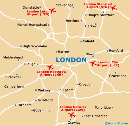
The city of London is the capital of England and contains many of the country's most famous buildings and tourist attractions, such as Buckingham Palace, home of the royal family. London is situated near to a number of prominent cities and towns, such as Crawley to the south, Gravesend and Gillingham to the east, and Maidenhead to the west. Also well-known are London's docklands, an important area of commerce centred around Canary Wharf and particularly close to London City Airport (LCY).
London is surrounded by the M25 motorway, which circles the entire city and can become busy during peak commuting hours. However, much of the city is easily accessible by using the fast and convenient London underground tube trains, which travel to most locations. Tube stations can be found all over the city, including many in the main suburban areas.
London City Airport (LCY) Maps: Important City Districts
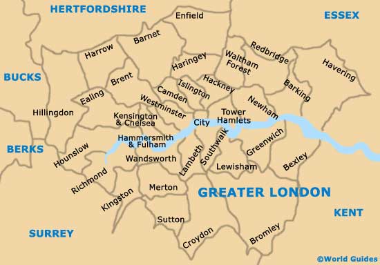
The city is split into a number of zoned areas, which are integrated into travel on the tube and directly relate to prices. London's zones are clearly marked on maps of the underground. Zone 1 is based around the city centre and includes areas such as Oxford Circus, Hyde Park Corner, Westminster and Sloane Square.
London City Airport is extremely close to the city centre and is located in Zone 3, near to Silvertown and the Pontoon Dock. Canary Wharf, Heron Quay and South Quay are all just a few stops away, in Zone 2. All of the stops are part of the popular Docklands Light Railway (DLR).
England Map

Greater London Map
London Map